

SKU: 9321438001744PLU: 148625UPC/EAN: 9321438001744
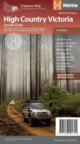
Hema High Country Victoria - South East Map - 1st Edition.
or pay nothing today with

- Delivery
- In-Store
- Click & Collect
- description. press to scroll to the description section.
- features. press to scroll to the features section.
- specifications. press to scroll to the specifications section.
- reviews. press to scroll to the reviews section.
description
This map is part of Hema's new Victorian High Country Map Series and covers the Southern Lowlands and Lakes Areas including Gippsland and Snowy River National Park. Printed on durable waterproof paper, this map features Hema's iconic mapping and extensive points of interest. Featuring roads and 4WD tracks field-checked by the Hema Map Patrol for superior accuracy.
It combines Hema’s entire database of roads and 4WD tracks with touring points of interest and topographic information. Also included are seasonal track closures, camping areas, old townsites, huts, accommodation and distances.
Glenmore Snowy River NP Part of Buthers Ridge Buchan Goongerah Errindunda NP Orbost Nowa Nowa Wygarra Lakes Entrance Newmerella Cabbage Tree creek Bellbird Creek Bonang Harrow Bairnsdale Bruthen Lake Tyers Lake King Lake Victoria Tamboo Crossing Swifts Creek Cassillis Historia Area Marthavale Walsh Cutting Johnsonville Swan Reach Nicholson
features
- 4WD tracks
- Huts
- Camping areas
- Old townsites
- Seasonal track closures
- Road distances
- Accommodation
specifications
Scale: 1:100,000
Folded size (WxHxD): 140mm x 250mm x 3mm
Flat size (WxH): 700mm x 1000mm
Weight: 0.09kgs