

SKU: 9780648337607PLU: 140884UPC/EAN: 9780648337607
Spatial Vision Bogong Alpine Area Map - Edition 4
$9.00
Save $5.95 (39%)RRP $14.95
Removed from Wishlist
or from $10/week with

- Delivery
- In-Store
- Click & Collect
- description. press to scroll to the description section.
- features. press to scroll to the features section.
- specifications. press to scroll to the specifications section.
- reviews. press to scroll to the reviews section.
description
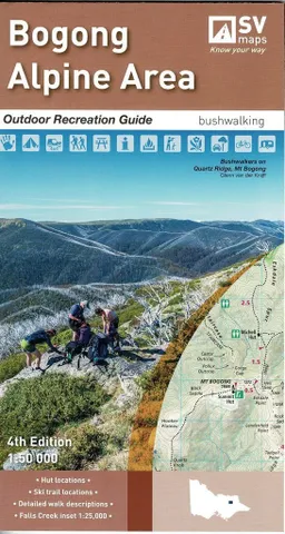
The Bogong Alpine Area recreation guide provides information and detailed maps for walking and touring from Mt Bogong to Mt Hotham. The Bogong Alpine Area recreation guide is the third in the Outdoor series and complements the already released Northern and Southern Grampians recreation guides. The Bogong Map covers Falls Creek, Mt Hotham, Dinner Plain and Mt Bogong
features
- Colour topographic map at 1:50 000 Scale
- Comprehensive walk descriptions and ratings
- Walk cross sections, campsite and huts waypoints
- Overnight hike descriptions
- Australian Alps Walking Track highlighted with walk descriptions
- Double sided map with enlargement of Falls Creek area showing ski trails
specifications
SCALE: 1:50,000
COVERAGE: Falls Creek, Mt Hotham, Dinner Plain and Mt Bogong
IDEAL FOR: Bushwalking, Cross-country skiing, mountain biking and car touring
EDITION: 4 (January 2019)
SIZE (folded): 135mm wide and 250mm high
SIZE (unfolded): 810mm wide by 1000mm high