

SKU: 9780992323264PLU: 136887UPC/EAN: 9780992323264
Spatial Vision Wilsons Promontory Map - Edition 2
or from $10/week with

- Delivery
- In-Store
- Click & Collect
- description. press to scroll to the description section.
- features. press to scroll to the features section.
- specifications. press to scroll to the specifications section.
- reviews. press to scroll to the reviews section.
description
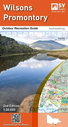
This recreation guide was developed in consultation with Parks Victoria and includes touring information by Glenn van der Knijff.
This map includes detailed walk descriptions including day walks such as the Lilly Pilly Gully, Mt Oberon and Oberon Bay and overnight walks including Southern Prom and Northern Prom walks. The map also includes information on other activities such as bushwalking, camping, flora and fauna, fire and flood and marine parks.
features
-
Information on activities such as bushwalking, camping, flora and fauna, fire and flood and marine parks are included.
-
Walks and facilities re-opened since Victorian Bushfires in 2009 and are now marked on this map.
-
Campground and Lookout locations and GPS references.
- 1:150,000 locality map of the Corner Inlet
specifications
SCALE: 1:50,000
MAJOR PARKS: Wilsons Promontory National Park, Wilsons Promontory Marine National Park, Corner Inlet Marine National Park, Wilsons Promontory Marine Reserve, Corner Inlet Marine and Coastal Park
LOCAL TOWNS including Tidal River, Yanakie, Sandy Point.
SIZE (folded): 135mm wide and 250mm high
SIZE (unfolded): 1000mm wide by 810mm high